Hidden Under Green: The New Great Wall of China
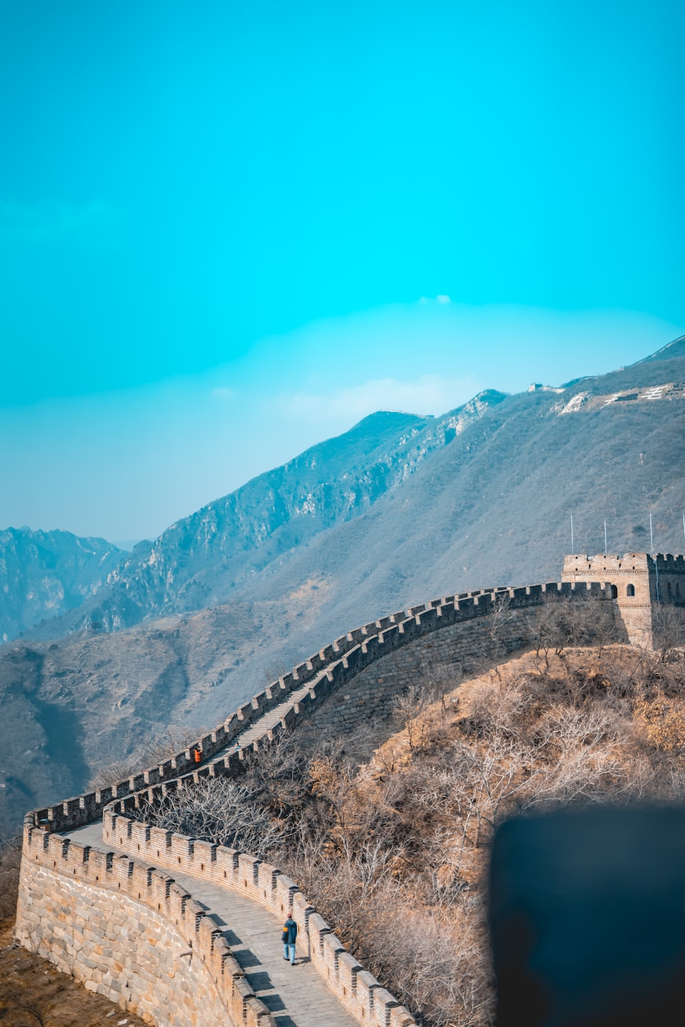
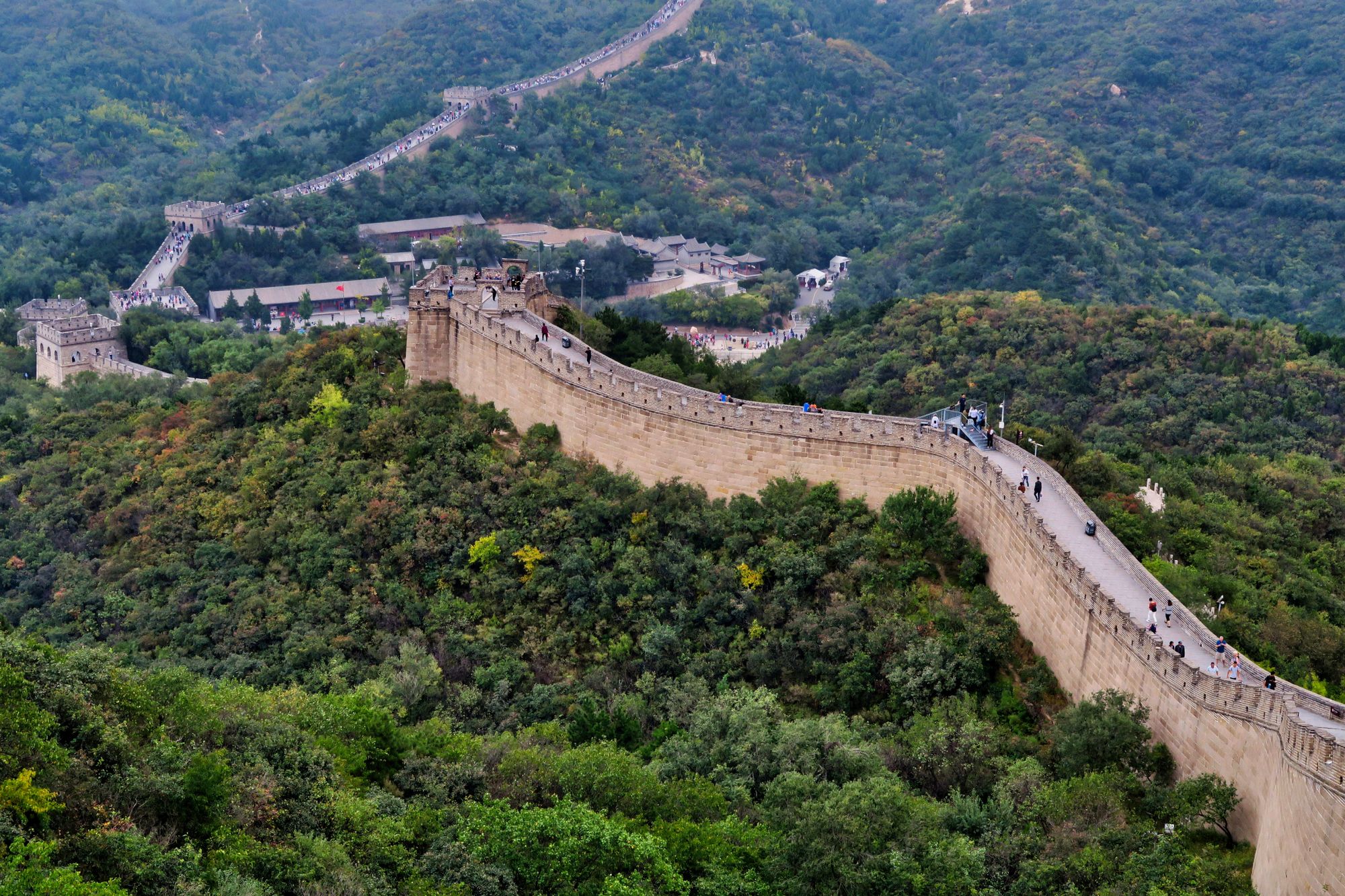
The Great Wall of China, is an incredible series of forts that extends more than 20,000 Km (13,000 miles), and proved crucial for the development of the nation.
It protected the northern border of China from the nomadic and warring states such as the Mongols, and in turn, diffused conflict into a lucrative trading relationship.
This was historically one of the most impactful anthropogenic influences on geopolitics.
What?
Well, that sentence above was some incomprehensible jargon. Let's break it down.
Anthropogenic, means human influenced or induced. Anthropo- means "human" in Greek, and -genic means "produced by".
Geopolitics is the fancy word for politics – most notably international relations – that is influenced by geography.
So to summarize the earlier statement:
The Great Wall of China is one of the greatest human actions taken, that intentionally altered the physical environment around them to deal with political issues – such as blocking an external invasion.
With such accounts of success, it is quite common for humans to reuse old tactics to deal with similar, modern issues. This is the case with China and a wall – but this time, it's green.
The "Great Green Wall" of China has been receiving a lot of attention in recent years.
This "Green Wall" is an effort to plant trees across one of China's most rampant deserts and deal with geopolitical issues. The wall is again placed up north, where intense desertification (which means that deserts are expanding) has been occurring. The impact of this growing desert carries its influence all the way to Korea and across the ocean to Japan – this phenomenon is referred to as "Yellow Dust"
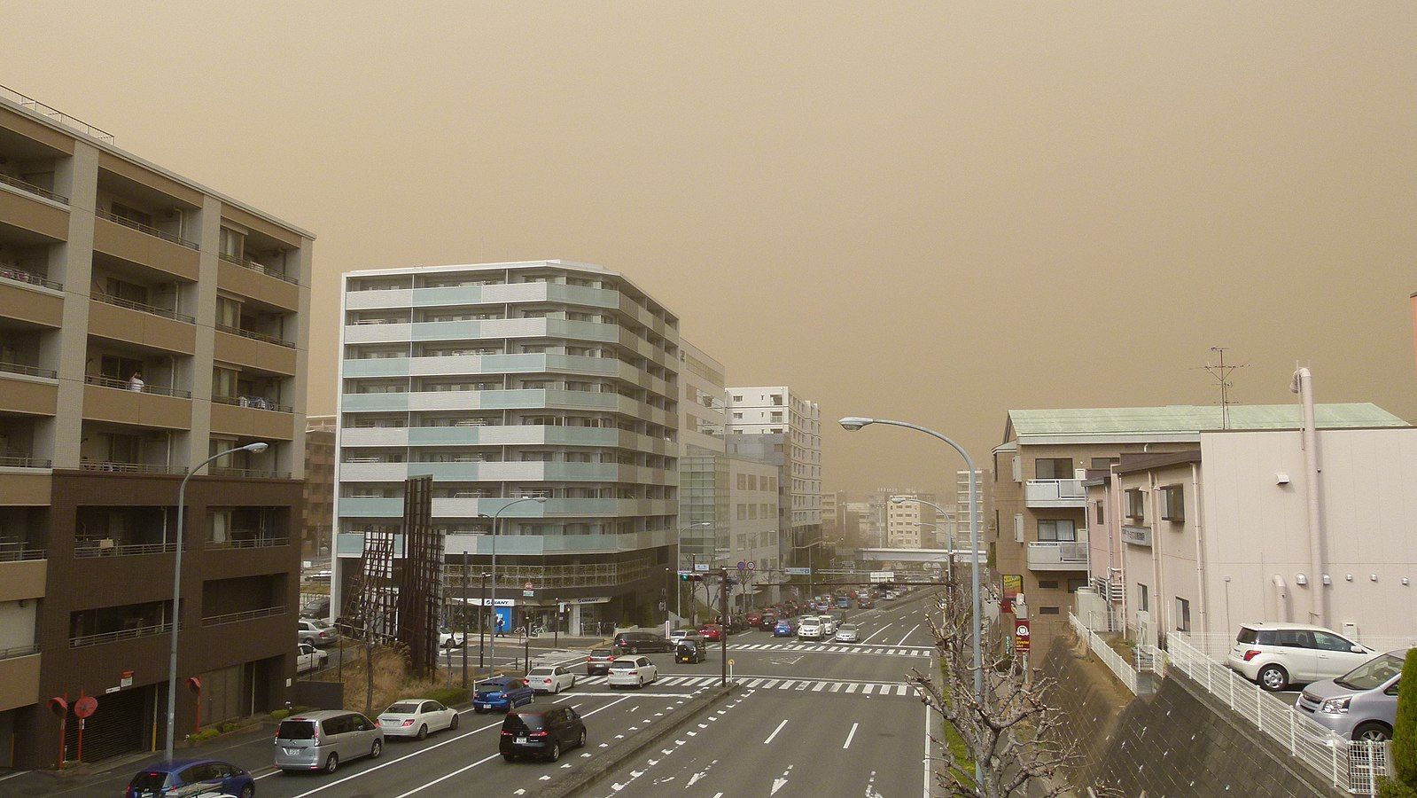
As seen in the image above, the sky turns completely brown and yellow due to the dust blown over from China's growing deserts. This obviously causes a lot of international tension, so this effort by China to not only stop desertification, but also plant more trees has been in the global spotlight.
China has been extremely active in its "fight against climate change", especially focused on reforesting their land. It has even been labeled as a "lesson for the world" and is a rare case of western praise for China.
However, there's another "Great Wall" of China that does not get as much attention – yet the geopolitical consequence of this wall is far more detrimental.
This "Great Wall" which I am concerned with is located down south – contrary to the international focus up north – centered in the Tibetan plateau. As you can see in the map below, many freshwater rivers are flowing out of the Tibetan Plateau to neighboring countries.
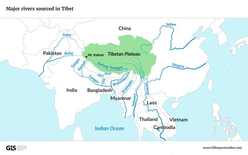
What's incredible, is that this reservoir of water supports about half the world's population.
Let me reiterate that fact.
More than 3 billion people rely on the water flowing out of this reservoir in the Tibetan Plateau.
This 'water tank' of the world has so far been largely untouched, mostly due to its climate and high elevation. With an average elevation of 4,500 meters (15,000 feet), it has been a harsh environment for not only humans, but other living creatures to survive. The incredible human society that continues to thrive in this region are the Tibetan people. The Tibetan people had a complex nation based upon the teachings of Buddhism, and were able to live in balance with the difficult climate of the Tibetan Plateau. However, this began to shift in 1949.

Over a 10 year period starting in 1949, the Chinese began to extend their political influence towards the Tibetans. This process of the annexation of Tibet is in need of its separate in-depth writing. To briefly summarize, the Tibetan leader – the Dalai Lama – was eventually exiled and the Chinese government officially took political, social, and religious control over Tibet. This in turn provided China the hegemony over rivers that flow out of the Tibetan Plateau.
To rephrase that: China came to control the main source of water that 3 billion people rely on.
During the years since, China has created about 87,000 dams to control and exploit the rivers flowing out of the Tibetan Plateau.
Furthermore, in the past decade, China has shown great interest to create more dams along the rivers that flow to other nations. This has caused a lot of international unrest, most notably with India and the Brahmaputra River. Although China asserts that the flow of the river will not be impacted by these dams, there is large debate upon the real influence these dams will have on downstream nations. I will call this array of erected dams, the "Wall of Dams", as it essentially creates a blockade for resources to flow in and out of this area. But this wall is not built solely with concrete and steel.
The unusual 'wall' that is being created on the Tibetan Plateau also takes the form of agriculture.
For centuries, the Tibetan Plateau lacked fertile land, making the Tibetan people rely upon their livestock – such as the Yak – for sustenance practices. However, in the past 50 years, temperatures have gradually been rising in this once barren land.
The increase in temperature slowly melts the ice formed up in the mountains of Tibet, which in turn makes the soil and land much more suitable for agriculture and tree growth (Silva et al., 2016).
This suitable change in climate for the growth of trees, aligned well with China's goal to reforest their land – increasing the forested areas of Tibet from roughly 9% to more than 12%. (Shu-Qin et al, 2021).
On top of this, with the growing fertility of their soil and the abundance of freshwater flow, about 40% of Tibet's land is used for irrigated agriculture today. Irrigated agriculture essentially is the practice of anthropogenically controlling water entering the farmland. This technique is used universally and is said to be the main consumer of water across the globe.
What does this mean?
It means, this new development of growing forests and proliferation of agriculture on the Tibetan Plateau, competes for water that flows downstream.
So with the coupling of these two factors – the concrete dams and the wall of trees/crops – the water available in the southern nations become the center for intense geopolitics.
As trees and agriculture continue to grow and consume water in Tibet, alongside the new dams in construction across the many transnational rivers; the tight grip China has over the lives of other nations is startling.
It is imaginable that if these neighboring nations fail to maintain good diplomatic relations with China, the source of life itself – water – could be cut off.
![[Guest Post] Exploring Colonial History through Art](/content/images/size/w750/2023/11/graphite-island-banner.png)